AGA publishes map of geothermal tenements in Australia
 Longreach, Queensland, Australia (source: Steven Penton / flickr, Creative Commons)


The Australian Geothermal Association has published an updated map of geothermal tenements in Australia, with more data available to members.
The Australian Geothermal Association (AGA) has published an updated map of current geothermal tenements and applications in Australia. The map shows the location and boundaries of geothermal sites (classified by type) and existing geothermal wells.
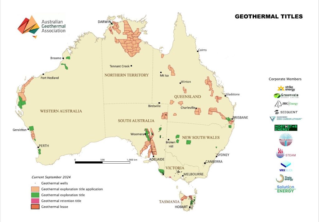
Members of the AGA can also be given access to an accompanying table with more details on the geothermal licenses, as well as a corresponding QGIS project.
Australia is at an interesting time of geothermal development, with interest seemingly waking up again in the Queensland and South Australia regions. Exploration efforts in Western Australia are at the earlier stages, notably with a recently announced geothermal acreage release.
Source: Australian Geothermal Association