Updated GeoThopica 2.0 geothermal data portal launched in Italy
 Front page of GeoThopica 2.0 (source: GeoThopica 2.0 website)


The Institute of Geosciences and Georesources of the National Resource Council has published an update of GeoThopica - Italy's national geothermal data platform.
The Institute of Geosciences and Georesources of the National Resource Council of Pisa (CNR-IGG) has officially launched GeoThopica 2.0 – an updated version of the institution’s Italian geothermal data infrastructure access portal. The portal can be accessed via this link – GeoThopica 2.0 (registration required).
The platform provides a wealth of resources including maps of geothermal potential and other reservoir characteristics, a thesaurus of industry terms, downloadable metadata, and a library of geothermal articles, documents, reports.
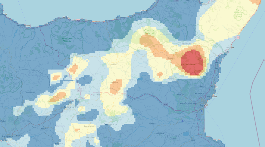
The heart of the Italian geothermal data infrastructure is the Italian National Geothermal Database (BDNG) which mainly contains stratigraphic and thermal data of the subsoil , data of geothermal interest from thermal springs, gaseous phenomena, wells, and numerous geochemical data described in the scientific literature.
The updated version of GeoThopica, which was originally created in 2007 by CNR-IGG, benefits from the BNDG currently containing about twice the data compared to when it was originally created. The most recent update of these data was made possible by the two national projects coordinated by the CNR, VIGOR and Geothermal Atlas of Southern Italy, dedicated to regions of Southern Italy.
GeoThopica 2.0 contains geothermal evaluation maps on a global scale obtained with machine learning and artificial intelligence technologies: a frontier research that the CNR tackles thanks to its wide multidisciplinarity. The infrastructure policy is inspired by the open science paradigm and the ecosystem of FAIR principles that allow its application. Indeed, the Italian geothermal data infrastructure was developed in such a way as to guarantee access, interoperability and re-use of the available information, in compliance with national regulations (the National Repertory of Spatial Data – Rndt 2.0),
Source: Corriere Nazionale